Berkeley Vale
- This pink map is just a guide. To view all stops, please see below.
- All Robin areas are separate.
- See all fixed line services at TravelineSW. You should use you Robin booking to connect with a fixed line service, or get to your destination if no fixed line is available.
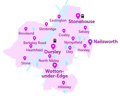
Below is the full list of bus stops where you can be collected or dropped off, within the Berkeley Vale area of The Robin.
- For the interactive map, and to book a journey, please log into the website
- Use our App (download on Apple or Android)
- If neither of these are possible, please call our Robin team: 0345 263 8139 📱
- Nailsworth is in the Berkeley Vale area. You can also book to/from Nailsworth in the South Cotswolds Robin area. This is to allow residents in this area to choose their preferred Robin service-area, and is not designed for onward travel into a second Robin area. All Robin areas are separate, using different vehicles, etc.
Stop name (Address) |
Village / District (A to Z) |
| St Kenelm's Church (NW), Wotton Cresent, Alderley | Alderley |
| St Kenelm's Church (SE), Wotton Cresent, Alderley | Alderley |
| Allotments (SW), Ashmead Green, Ashmead Green | Ashmead Green |
| Allotments (NE), Ashmead Green, Ashmead Green | Ashmead Green |
| Ashmead Hall (SE), Cam Green, Ashmead Green | Ashmead Green |
| Ashmead Hall (NW), Cam Green, Ashmead Green | Ashmead Green |
| Post Office (E), Salter Street, Berkeley | Berkeley |
| Post Office (W), Salter Street, Berkeley | Berkeley |
| Berkeley Vale Park (NW), Bevans Hill, Berkeley | Berkeley |
| Berkeley Vale Park (SE), Lynch Road, Berkeley | Berkeley |
| Berkeley Castle (E), Canonbury Street, Berkeley | Berkeley |
| Berkeley Castle (W), Canonbury Street, Berkeley | Berkeley |
| Canon Park (S), Station Road, Berkeley | Berkeley |
| Canon Park (N), Station Road, Berkeley | Berkeley |
| The Common (W), B4066, Berkeley Heath | Berkeley Heath |
| The Common (E), B4066, Berkeley Heath | Berkeley Heath |
| Berkeley Turn (NE), B4066, Berkeley Heath | Berkeley Heath |
| Berkeley Turn (SW), B4066, Berkeley Heath | Berkeley Heath |
| Prince of Wales (SW), Berkeley Road | Berkeley Road |
| Prince of Wales (NE), Berkeley Road | Berkeley Road |
| Keeper's Cottage (SE), Gloucester Road, Bournstream | Bournstream |
| Keeper's Cottage (NW), Gloucester Road, Bournstream | Bournstream |
| Cotswold Edge Golf Club (NE), B4058 Upper Rushmire, Bowcott | Bowcott |
| Cotswold Edge Golf Club (SW), B4058 Upper Rushmire, Bowcott | Bowcott |
| Bushy Farm (SE), Pool Farm Lane, Breadstone | Breadstone |
| Bushy Farm (NW), Pool Farm Lane, Breadstone | Breadstone |
| Little Acre (NW), Breadstone, Breadstone | Breadstone |
| Little Acre (SE), Breadstone, Breadstone | Breadstone |
| Haven Avenue (N), Downton Road, Bridgend | Bridgend |
| Haven Avenue (S), Downton Road, Bridgend | Bridgend |
| Farm (S), Church Lane, Brookend | Brookend |
| Farm (N), Church Lane, Brookend | Brookend |
| Lammastide Inn (NW), Church Lane, Brookend | Brookend |
| Lammastide Inn (SE), Church Lane, Brookend | Brookend |
| Wickster's Bridge (NE), A38, Cambridge | Cambridge |
| Wickster's Bridge (SW), A38, Cambridge | Cambridge |
| Elm Farm (SW), A38, Cambridge | Cambridge |
| Elm Farm (NE), A38, Cambridge | Cambridge |
| Homeleigh (NE), Bristol Road A38, Cambridge | Cambridge |
| Ryalls Lane (S), A38, Cambridge | Cambridge |
| Ryalls Lane (N), A38, Cambridge | Cambridge |
| Hilltop Garage (NW), Claypits | Claypits |
| Hilltop Garage (SE), Claypits | Claypits |
| Betworthy Estate (NW), The Street, Coaley | Coaley |
| Betworthy Estate (NE), The Close, Coaley | Coaley |
| Pumping Station (S), Coombe Lane, Coombe | Coombe |
| Cam & Dursley Rail Station, Draycott | Draycott |
| Coaley Junction (S), A4135, Draycott | Draycott |
| Coaley Junction (N), A4135, Draycott | Draycott |
| Everside Lane (NE), Manor Avenue, Draycott | Draycott |
| Draycott Business Park (N), Draycott Business Park, Draycott | Draycott |
| Draycott Business Park (S), Draycott | Draycott |
| May Lane (NW), Parsonage Street, Dursley | Dursley |
| Sainsbury's (SE), Castle Street, Dursley | Dursley |
| Sainsbury's (NW), Castle Street, Dursley | Dursley |
| Carpenters Arms (W), Uley Road, Dursley | Dursley |
| Carpenters Arms (E), Uley Road, Dursley | Dursley |
| Tesco, Cam & Dursley | Dursley |
| Sylvern (SE), Bath Road, Eastington | Eastington |
| Sylvern (NW), Bath Road, Eastington | Eastington |
| Middle Street (NW), Bath Road, Eastington | Eastington |
| Middle Street (SE), Bath Road, Eastington | Eastington |
| Alkerton Cross (SE), Eastington | Eastington |
| Alkerton Cross (NW), Eastington | Eastington |
| The Old Chapel (NW), Main Street, Far Green | Far Green |
| The Old Chapel (SE), Main Street, Far Green | Far Green |
| Ashmead Turn (SE), Main Street, Far Green | Far Green |
| Ashmead Turn (NW), Main Street, Far Green | Far Green |
| Hazel Court (SW), Nortonwood, Forest Green | Forest Green |
| Carters Way (SW), Nortonwood, Forest Green | Forest Green |
| Nailsworth Primary School (NW), Nympsfield Road, Forest Green | Forest Green |
| Nailsworth Primary School (SE), Nympsfield Road, Forest Green | Forest Green |
| The George Inn (NW), Bath Road, Frocester | Frocester |
| The George Inn (SE), Bath Road, Frocester | Frocester |
| Frampton Turn (SW), A38, Fromebridge | Fromebridge |
| Frampton Turn (NE), A38, Fromebridge | Fromebridge |
| Skillzone | Gloucester |
| Slimbridge Lane (N), Main Street, Halmore | Halmore |
| Slimbridge Lane (S), Main Street, Halmore | Halmore |
| Power Station (N), Hamfields, Ham | Ham |
| Trenley Road (SE), Main Street, Hamshill | Hamshill |
| Trenley Road (NW), Main Street, Hamshill | Hamshill |
| Star Inn Cottage (S), A38, Heathfield | Heathfield |
| Star Inn Cottage (N), A38, Heathfield | Heathfield |
| Dursley Primary School (NW), School Road, Highfields | Highfields |
| St Giles' Church (SW), High Street, Hillesley | Hillesley |
| St Giles' Church (NE), High Street, Hillesley | Hillesley |
| Sharpness Turn (N), Wanswell Road, Hinton | Hinton |
| Sharpness Turn (S), Wanswell Road, Hinton | Hinton |
| The Hog Inn (SE), The Street, Horsley | Horsley |
| The Hog Inn (NW), The Street, Horsley | Horsley |
| Sallywood Farm (W), B4058, Horsley | Horsley |
| Sallywood Farm (E), B4058, Horsley | Horsley |
| Elmlea Road (N), Church Street, Kings Stanley | Kings Stanley |
| Elmlea Road (S), Church Street, Kings Stanley | Kings Stanley |
| King's Head (N), High Street, Kings Stanley | Kings Stanley |
| King's Head (NW), Broad Street, Kings Stanley | Kings Stanley |
| Priory Court (NW), Blackboys, Kingshill | Kingshill |
| Priory Court (S), Blackboys, Kingshill | Kingshill |
| St Georges Road (NE), St Georges Road, Kingshill | Kingshill |
| St George's Road (SW), St George's Road, Kingshill | Kingshill |
| Rednock School (N), Kingshill Road, Kingshill | Kingshill |
| Bramley Close (NE), Walk Mill Lane, Kingswood | Kingswood |
| War Memorial (N), Kingswood | Kingswood |
| War Memorial (S), Kingswood | Kingswood |
| Tennis Court (E), Charfield Road, Kingswood | Kingswood |
| Tennis Court (NW), Charfield Road, Kingswood | Kingswood |
| Garage (SE), Stanley Downton Road, Leonard Stanley | Leonard Stanley |
| Garage (NW), Stanley Downton Road, Leonard Stanley | Leonard Stanley |
| Seven Waters (W), Bath Road, Leonard Stanley | Leonard Stanley |
| Seven Waters (E), Bath Road, Leonard Stanley | Leonard Stanley |
| Village Hall (N), Marsh Road, Leonard Stanley | Leonard Stanley |
| Village Hall (S), Marsh Road, Leonard Stanley | Leonard Stanley |
| St Swithun's Church (SE), Church Road, Leonard Stanley | Leonard Stanley |
| St Swithun's Church (W), Church Road, Leonard Stanley | Leonard Stanley |
| Manor Close (NE), Manor Avenue, Lower Cam | Lower Cam |
| Jubilee Tree (NW), High Street, Lower Cam | Lower Cam |
| Jubilee Tree (SE), High Street, Lower Cam | Lower Cam |
| Pevelands (N), Manor Avenue, Lower Cam | Lower Cam |
| Pevelands (S), Manor Avenue, Lower Cam | Lower Cam |
| Leaside Close (SE), Woodview Road, Lower Cam | Lower Cam |
| Leaside Close (NW), Woodview Road, Lower Cam | Lower Cam |
| Everlands School (NW), Birch Road, Lower Cam | Lower Cam |
| Everlands School (SE), Birch Road, Lower Cam | Lower Cam |
| Chip Shop school stop (SE), High Street, Lower Cam | Lower Cam |
| Coombe Lane (NW), Broad Street, Middleyard | Middleyard |
| Coombe Lane (SE), Broad Street, Middleyard | Middleyard |
| Mobley Farm (S), Mobley | Mobley |
| Mobley Farm (N), Alkington Lane, Mobley | Mobley |
| Concord Sheltered Housing (E), Newmarket Road, Nailsworth | Nailsworth |
| Concord Sheltered Housing (S), Off Newmarket Road, Nailsworth | Nailsworth |
| Morrisons, George Street | Nailsworth |
| Nailsworth Garden Centre | Nailsworth |
| Nastend Lane (NW), A419, Nastend | Nastend |
| Nastend Lane (SE), A419, Nastend | Nastend |
| The George Inn (SE), Newmarket Road, Newmarket | Newmarket |
| Haycroft Lane (N), A38, Newport | Newport |
| Haycroft Lane (S), Newport | Newport |
| Sharpness Primary School (W), Bays Hill, Newtown | Newtown |
| Sharpness Primary School (E), Bays Hill, Newtown | Newtown |
| Saniger Farm (SE), Newtown | Newtown |
| Saniger Farm (NW), B4066, Newtown | Newtown |
| Black Horse Inn (S), New Road B4060, North Nibley | North Nibley |
| Black Horse Inn (N), New Road B4060, North Nibley | North Nibley |
| Barrs Lane Shop (NE), Barrs Lane, North Nibley | North Nibley |
| Barrs Lane Shop (SW), Barrs Lane, North Nibley | North Nibley |
| Robert Hubert Lane (E), Nupend | Nupend |
| Robert Hubert Lane (W), Nupend | Nupend |
| Rose & Crown (SE), Nympsfield | Nympsfield |
| Rose & Crown (NW), Nympsfield | Nympsfield |
| Tinkley Farm (SE), Tinkley Lane, Nympsfield | Nympsfield |
| Tinkley Farm (NW), Tinkley Lane, Nympsfield | Nympsfield |
| Woodchester Park, Tinkley Gate | Nympsfield |
| Coaley Peak (Nympsfield Long Barrow) | Nympsfield |
| Rowbotham Way (N), Oldend | Oldend |
| Rowbotham Way (S), Oldend | Oldend |
| St John's Church (SE), Halmore Road, Purton | Purton |
| St John's Church (NW), Halmore Road, Purton | Purton |
| Cricket Ground (N), Selsley Hill, Selsley | Selsley |
| Cricket Ground (S), Selsley Hill, Selsley | Selsley |
| All Saint's Church (SW), Pooles Lane, Selsley | Selsley |
| All Saint's Church (NE), Pooles Lane, Selsley | Selsley |
| The Knapp (NE), Broad Street, Selsley | Selsley |
| The Knapp (SW), Broad Street, Selsley | Selsley |
| Oldminster Road (N), Oldminster Road, Sharpness | Sharpness |
| Oldminster Road (S), Oldminster Road, Sharpness | Sharpness |
| Oakfield Way (S), Oldminster Road, Sharpness | Sharpness |
| Oakfield Way (N), Oldminster Road, Sharpness | Sharpness |
| Homefield Turn (NE), Wallow Green Lane, Shortwood | Shortwood |
| Homefield Turn (SW), Wallow Green Lane, Shortwood | Shortwood |
| Beehive Stores (NW), Churchend, Slimbridge | Slimbridge |
| Beehive Stores (SE), Churchend, Slimbridge | Slimbridge |
| Crossroads (NE), Bristol Road, Slimbridge | Slimbridge |
| Tyning Crescent (SE), St John's Road, Slimbridge | Slimbridge |
| Tyning Crescent (NW), St John's Road, Slimbridge | Slimbridge |
| WWT Slimbridge wildlife reserve | Slimbridge |
| The Tudor Arms (NW) | Slimbridge |
| The Tudor Arms (SE) | Slimbridge |
| Southend Farm (N), B4060, Southend | Southend |
| Southend Farm (S), B4060, Southend | Southend |
| Mill House (SE), Stancombe | Stancombe |
| Mill House (NW), Stancombe | Stancombe |
| Court Farms (SE), B4008, Standish | Standish |
| The Old Fleece (S), Stanley Downton | Stanley Downton |
| The Old Fleece (N), Stanley Downton | Stanley Downton |
| Townsend Farm (SW), The Street B4060, Stinchcombe | Stinchcombe |
| Townsend Farm (NE), The Street B4060, Stinchcombe | Stinchcombe |
| Yercombe Lodge (NW), Stinchcombe | Stinchcombe |
| Yercombe Lodge (SE), Stinchcombe | Stinchcombe |
| Stone Court (N), A38, Stone | Stone |
| Stone Court (S), A38, Stone | Stone |
| All Saints' Church (S), Stone | Stone |
| All Saints' Church (NE), A38, Stone | Stone |
| Downton Road (W), Stonehouse | Stonehouse |
| Downton Road (E), Bristol Road A419, Stonehouse | Stonehouse |
| Skf Works (S), Oldends Lane, Stonehouse | Stonehouse |
| Skf Works (N), Oldends Lane, Stonehouse | Stonehouse |
| Crowcumepill (N), Gloucester Road B4008, Stonehouse | Stonehouse |
| Crowcumepill (S), Gloucester Road B4008, Stonehouse | Stonehouse |
| Globe Inn (N), High Street, Stonehouse | Stonehouse |
| Medical Centre (S), High Street, Stonehouse | Stonehouse |
| Railway Station (SE), Stonehouse | Stonehouse |
| Magpies Football Ground (W), Oldends Lane, Stonehouse | Stonehouse |
| Magpies Football Ground (E), Oldends Lane, Stonehouse | Stonehouse |
| Maidenhill School (E), Woodcock Lane, Stonehouse | Stonehouse |
| Maidenhill School (W), Woodcock Lane, Stonehouse | Stonehouse |
| Tescos, Stratford Road | Stroud |
| Sainsburys Dudbridge Stroud | Stroud |
| The Old Barn (S), Stroud Green | Stroud Green |
| The Old Barn (N), B4008, Stroud Green | Stroud Green |
| Full Moon (N), Mount Pleasant, Synwell | Synwell |
| Full Moon (SE), The Green, Synwell | Synwell |
| Tilsdown Close (SW), Meadow Vale, Tilsdown | Tilsdown |
| Tilsdown Close (NE), Meadow Vale, Tilsdown | Tilsdown |
| Cam Pitch (SE), Tilsdown, Tilsdown | Tilsdown |
| Cam Pitch (NW), Tilsdown, Tilsdown | Tilsdown |
| Phone Box (W), Furlong Lane, Tresham | Tresham |
| Phone Box (E), Furlong Lane, Tresham | Tresham |
| Post Office (SW), The Street B4066, Uley | Uley |
| Post Office (NE), The Street B4066, Uley | Uley |
| Hopton Green (SE), Hopton Road, Upper Cam | Upper Cam |
| Hopton Green (NW), Hopton Road, Upper Cam | Upper Cam |
| Hopton Road (NW), Hopton Road, Upper Cam | Upper Cam |
| Hopton Road (SE), Hopton Road, Upper Cam | Upper Cam |
| Playing Field (W), Upthorpe, Upthorpe | Upthorpe |
| Playing Field (E), Cam Green, Upthorpe | Upthorpe |
| Ragnal Lane (W), Shortwood Road, Walkleywood | Walkleywood |
| Ragnal Lane (E), Shortwood Road, Walkleywood | Walkleywood |
| The Laurels (W), Halmore Road, Wanswell | Wanswell |
| The Laurels (E), Halmore Road, Wanswell | Wanswell |
| Abwell (N), Berkeley Road, Wanswell | Wanswell |
| Abwell (S), Berkeley Road, Wanswell | Wanswell |
| Vale of Berkeley College (N), Berkeley Road, Wanswell | Wanswell |
| Vale of Berkeley College (S), Berkeley Road, Wanswell | Wanswell |
| Quarry (S), Horsley Road, Whiteway | Whiteway |
| Quarry (N), Horsley Road, Whiteway | Whiteway |
| Attwoolls (S), A38, Whitminster | Whitminster |
| Attwoolls (N), A38, Whitminster | Whitminster |
| Primary School (SE), School Lane, Whitminster | Whitminster |
| Grove End Farm (SE), Grove Lane, Whitminster | Whitminster |
| Grove End Farm (NW), Grove Lane, Whitminster | Whitminster |
| Tilsdown Close (SW), Woodfield Road, Woodfield | Woodfield |
| Tilsdown Close (NE), Woodfield Road, Woodfield | Woodfield |
| Cam Lodge (SW), Dursley Road, Woodfield | Woodfield |
| Yew Tree Inn (NE), Woodfield Road, Woodfield | Woodfield |
| Yew Tree Inn (SW), Woodfield Road, Woodfield | Woodfield |
| Damery Lane (NE), A38, Woodford | Woodford |
| Damery Lane (SW), Woodford | Woodford |
| Byron Road (SW), Byron Road, Woodmancote | Woodmancote |
| Cambridge House (S), Cambridge Avenue, Woodmancote | Woodmancote |
| Cambridge House (N), Woodmancote | Woodmancote |
| Elmtree Cottages (S), Wortley | Wortley |
| Elmtree Cottages (N), Wortley | Wortley |
| War Memorial (E), Wotton-under-Edge | Wotton-under-Edge |
| War Memorial (W), Old Town, Wotton-under-Edge | Wotton-under-Edge |
| Bearlands (S), Wortley Road, Wotton-under-Edge | Wotton-under-Edge |
| Bearlands (N), Wotton-under-Edge | Wotton-under-Edge |
| Gloucester Row (N), Bradley Road, Wotton-under-Edge | Wotton-under-Edge |
| Gloucester Row (S), Bradley Road, Wotton-under-Edge | Wotton-under-Edge |
| Valley Road (NE), Coombe Road, Wotton-under-Edge | Wotton-under-Edge |
| Valley Road (SW), Culverhay, Wotton-under-Edge | Wotton-under-Edge |
| Westfields (Chipping Surgery) | Wotton-under-Edge |
| Symn Lane (Chipping Surgery) | Wotton-under-Edge |
Last reviewed: